For years, Reynisfjara was the photograph that launched a thousand itineraries. That sweeping arc of obsidian sand, the hexagonal basalt columns of Gardar rising like a petrified cathedral organ, the Reynisdrangar sea stacks standing in the surf like fossilized trolls caught by daylight. It was the image plastered across every Iceland guidebook, every travel blog, every drone reel on social media. And for good reason. There are few places on earth where the collision of Atlantic fury and volcanic geology produces something so starkly, hauntingly beautiful. But Reynisfjara in 2026 is not the Reynisfjara of a decade ago, and travelers heading to Iceland's south coast need to know what has changed and where else to look.
What Happened at Reynisfjara
The trouble at Reynisfjara was never geological. The basalt columns still stand. The sand is still black. The problem has always been human, and it arrived on two fronts. First, there are the sneaker waves. The southern coast of Iceland faces the full fetch of the North Atlantic, and Reynisfjara sits at a particularly exposed angle where wave energy concentrates in unpredictable surges. These are not ordinary waves. They roll in with little warning, sometimes reaching far beyond what visitors expect, pulling people off their feet and into water cold enough to kill within minutes. Multiple fatalities and near-drownings over the years led Icelandic authorities to implement increasingly strict access restrictions. Sections of the beach that were once open for wandering are now cordoned off. Warning signs have multiplied. During rough weather, the beach closes entirely.
The second problem was sheer volume. Iceland's tourism boom, which saw annual visitor numbers surge from around 500,000 in 2010 to well over two million by the early 2020s, hit Reynisfjara particularly hard. The beach sits just off the Ring Road, a short detour from Vik, making it one of the easiest natural attractions to reach on the south coast. Tour buses began arriving in waves of their own. The parking area, never designed for mass tourism, became a bottleneck. The experience of standing alone on a primordial shore, listening to the hiss of retreating surf over volcanic gravel, gave way to navigating crowds, selfie sticks, and the constant hum of diesel engines idling in the lot. Seasonal crowd-management measures and timed entry systems have helped, but the wild, solitary character of the place has been fundamentally altered.
None of this means Reynisfjara is not worth visiting. It remains a geological marvel. But if your image of the place comes from photographs taken in empty morning light with no one else in frame, you should adjust your expectations. And more importantly, you should know that Iceland's volcanic coast extends for hundreds of kilometers in both directions, and some of the most extraordinary black sand landscapes in the country receive a fraction of the attention.
Vik's Other Shores
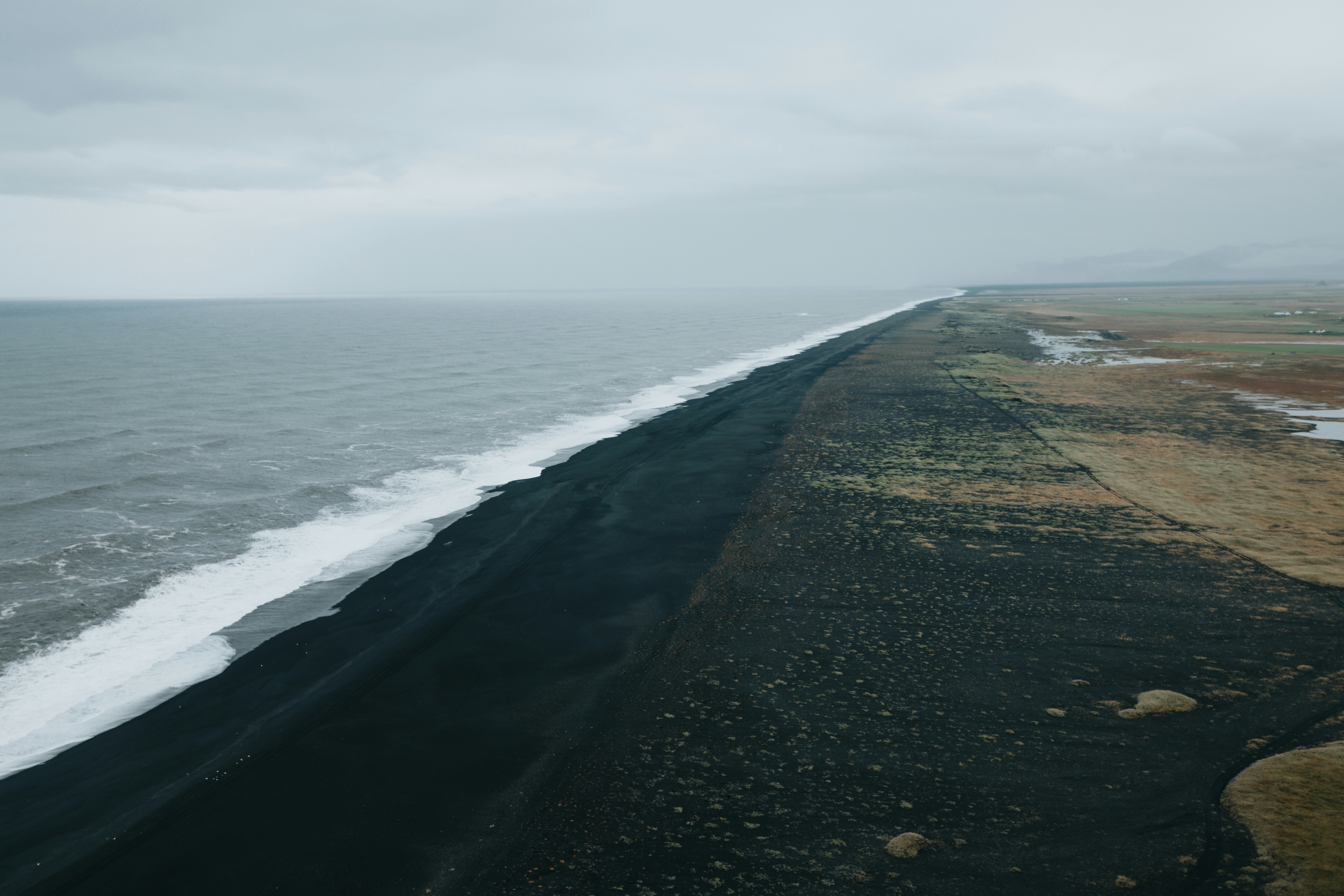
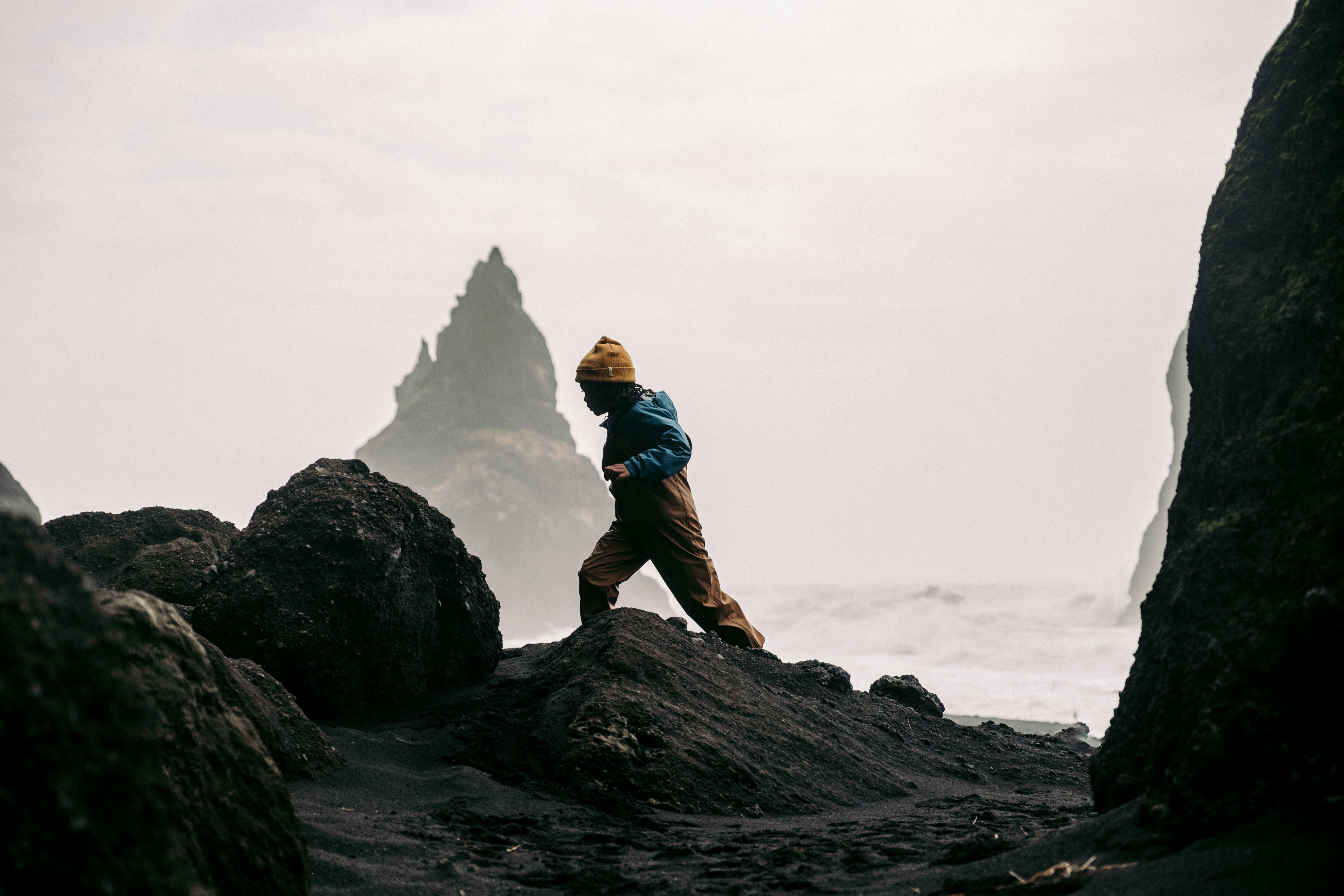
The village of Vik i Myrdal is perched above its own black sand beach, distinct from Reynisfjara and far less visited despite being literally steps from town. The beach at Vik stretches east from the base of the village's iconic church-topped hill, and from it you get a different perspective on the Reynisdrangar sea stacks, seeing them from a greater distance where they merge with the headland into a single dramatic silhouette. The sand here is the same fine-grained volcanic material, dark enough to absorb light and warm to the touch on the rare sunny day, but the beach curves gently rather than cutting straight into the cliffs. It is a more approachable shore, less dramatic but also less dangerous, with a gentler gradient and fewer of the rogue wave risks that plague Reynisfjara.
Walking east along Vik's beach brings you to Dyrholaey, the massive rock arch that juts into the sea like the prow of a ship. The promontory can be reached by road from above, but approaching it on foot along the sand is a different experience entirely. You feel the scale of the thing gradually, watching it grow from a shape on the horizon into something imposing and ancient. Puffins nest on the cliffs here from mid-April through August, and the combination of black sand, crashing surf, seabirds wheeling overhead, and that monumental arch framing the ocean beyond is as cinematic as anything on the south coast. A lighthouse sits on top, and if you climb up from the eastern side, the panoramic view stretches from the Myrdalsjokull glacier cap to the endless black coastline dissolving into sea spray to the west.
Solheimasandur and the Diamond Beach
West of Vik, the landscape opens into Solheimasandur, a vast outwash plain of black sand that stretches between the Solheimajokull glacier and the coast. This is where the famous DC-3 plane wreck sits, the fuselage of a United States Navy aircraft that crash-landed in 1973 and has been slowly surrendering to the elements ever since. The walk to the wreck is about four kilometers each way from the parking area, across flat, featureless black desert. It is bleak and beautiful in equal measure, the kind of landscape that makes you feel like you have wandered onto the surface of another planet. On overcast days, when the sand merges with a low grey sky and the horizon line disappears entirely, the effect is genuinely disorienting. There is no trail. You simply walk toward the coast, following the tire tracks left by the occasional rescue vehicle, until the ghostly shape of the fuselage emerges from the void.
Farther east, past Vik and the glacial lagoons, Diamond Beach near Jokulsarlon offers a completely different take on Iceland's dark shoreline. Here, icebergs calved from Breidamerkurjokull glacier wash out of the lagoon and onto the black sand, where they sit like enormous gemstones, translucent blue and white against the dark ground. The contrast is staggering. Every piece of ice is a different shape, sculpted by current and tide, and they change by the hour as new bergs arrive and old ones melt away. Visiting at sunrise, when the low Arctic light catches the ice and sets it glowing against the dark beach, is one of those travel experiences that genuinely justifies the word "unforgettable." The beach is well-known, and tour buses do stop here, but the scale of the shoreline absorbs the crowds better than Reynisfjara's confined cove.
"Iceland's coastline does not repeat itself. Every beach is a different conversation between fire and water, and the best ones are the ones nobody told you about." -- Ember Travel Co. Field Notes, South Iceland
Stokksnes and Vestrahorn
If you are willing to push beyond the standard south coast route, Stokksnes peninsula near Hofn in the southeast offers what many photographers consider the single most dramatic beach landscape in Iceland. The beach itself is black sand, but it is the backdrop that elevates the scene. Vestrahorn, a 454-meter horn of gabbro and granophyre rock, rises directly behind the shoreline in a series of jagged peaks that look like they were designed by a fantasy illustrator with no interest in geological plausibility. The mountain changes character completely depending on the light. Under clear skies it is sharp and imposing. In fog, it becomes a ghostly suggestion, its upper reaches vanishing into cloud. When the tide is low, pools of water collect on the flat sand, creating mirror reflections of the mountain that double the visual impact.
Stokksnes is accessed through a Viking Village film set, a collection of turf-roofed structures built for a movie that was never completed. There is a small admission fee, which helps limit traffic, and the result is a beach that feels genuinely remote even though it sits just off the Ring Road. On a weekday morning in shoulder season, you may have the entire stretch of sand to yourself, with nothing but the wind, the surf, and that impossible mountain filling the frame. It is the kind of place that makes you put your phone away and simply stand there.
The Westman Islands
The Vestmannaeyjar archipelago sits about thirty minutes by ferry from the mainland town of Landeyjahofn, and yet it feels like a different country. The main island, Heimaey, is famous for the 1973 eruption of Eldfell that buried a third of the town under lava and ash. Today the volcano is a red-brown cone you can hike in twenty minutes, and its flanks are still warm to the touch in places where residual heat seeps through the ground. But it is the coastline that commands attention. Heimaey's shores are a wild mix of black sand coves, sea caves, towering cliffs, and lava fields that tumbled into the ocean during the eruption and now form a new, raw-edged extension of the island.
The black sand beach at Stafkirkja, on the island's southern tip, sits beneath cliffs where millions of puffins nest each summer. It is one of the largest Atlantic puffin colonies in the world, and seeing the birds from the beach, tiny silhouettes wheeling against the cliff face, while standing on sand so dark it seems to swallow the light, is an experience unique to the Westman Islands. The archipelago also offers boat tours that circle the smaller, uninhabited islands, passing sea stacks, natural arches, and hidden coves accessible only by water. Surtsey, the island born from a submarine eruption in 1963, is visible on clear days from Heimaey's southern cliffs, a reminder that Iceland's volcanic coastline is still actively being created.
The Westman Islands are often skipped by travelers who view the ferry crossing as an inconvenience. That perception is a gift to those who make the trip. The islands offer the kind of solitude and raw volcanic landscape that Reynisfjara used to provide, with the added dimension of a living community shaped by eruption and ocean.
Ember Travel Tip: Planning Your Ring Road Beach Itinerary
Most travelers on the Ring Road rush through the south coast in a single day, hitting Reynisfjara and Diamond Beach before pushing on toward Hofn. We recommend a different approach. Build three nights into your south coast segment: one near Vik to explore Dyrholaey and Solheimasandur at sunset when the light is extraordinary, one near Jokulsarlon for an early-morning Diamond Beach visit before the buses arrive, and one near Hofn to catch Stokksnes at golden hour. If you have a day to spare, the Westman Islands ferry is absolutely worth the detour.
Timing matters enormously. June and July offer midnight sun and puffin season but also peak crowds. September brings dramatic skies, the first hints of northern lights, and far fewer visitors on every beach. Winter transforms these shores entirely, with black sand against snow, ice-encrusted basalt, and the violent beauty of storms rolling in from the Atlantic. Each season tells a different story.
At Ember Travel Co., we build Iceland Ring Road itineraries that account for weather windows, daylight hours, and the specific beaches you want to prioritize. We handle accommodation bookings near the best coastal access points, arrange the Westman Islands ferry, and make sure your rental vehicle is equipped for highland conditions if you want to venture off the main route. Reach out to start planning.